
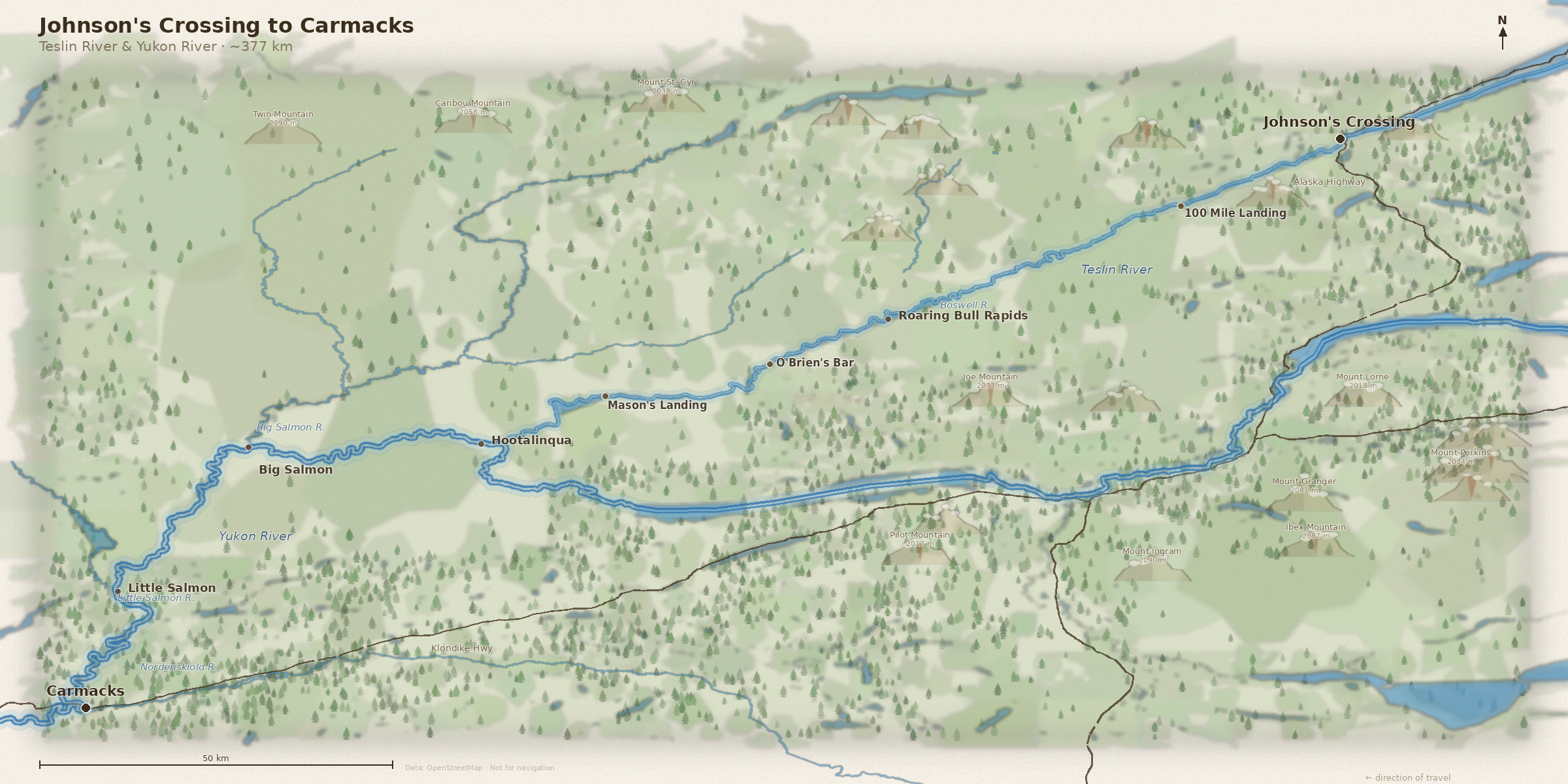
Getting there
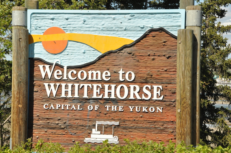
The Teslin/Yukon had long been on our paddling bucketlist. After almost five months of planning and preparation, the time had finally come on 28 June. We flew via Vancouver to Whitehorse, the capital of the Yukon Territory. Capital should actually be in quotation marks here, as the Yukon’s population of just under 40,000 is spread generously over an area the size of Germany, Switzerland and Austria combined. Whitehorse exudes the (very brittle) charm of a frontier town. We spent the next two days and nights digesting the 9-hour time difference, organizing the inevitably missing bits of gear, shopped basic foodstock for two weeks and indulged in a little final culinary pampering before setting off for Johnsons Crossing on the 30th.
Johnson's Crossing
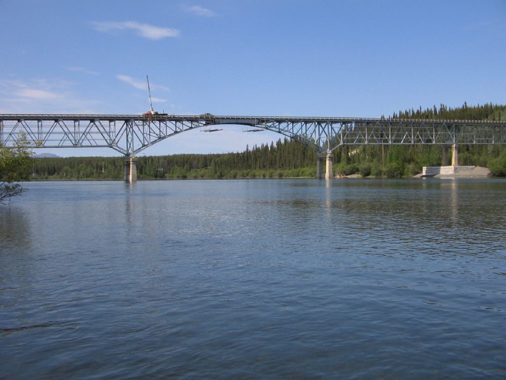
Johnson’s Crossing marks one of the most strategically important points on the Teslin River. Located where the Alaska Highway spans the river, it has long served as a logistical node; first for river travelers, later for road traffic. The origin of the name is debated: it may refer to Teslin Tlingit Chief George Johnston, who built a short road and operated a taxi service in the 1920s despite there being no proper roads in the community, or to Colonel Frank Johnson of the Corps of Engineers during construction of the Alaska Highway in 1942. Today, Johnson’s Crossing represents the transition from river frontier to highway infrastructure—a place where northern travel shifted from paddle and paddlewheel to diesel and asphalt, while the Teslin continues to flow quietly beneath the bridge. We arrived under the bridge just in time for our last “real” breakfast at the Johnson’s Crossing lodge. GREAT Pancakes!!
Shakedown
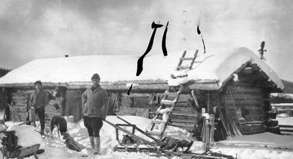
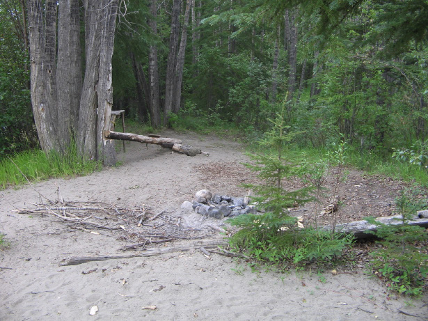
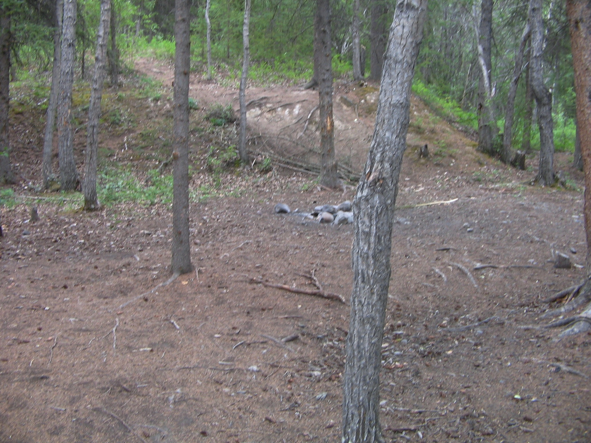
We had planned only a relatively short ‘shakedown’ for this day, so we set up our first camp after just 25 kilometres. Many of the camps have been in use for more than a hundred years, and even though they offer nothing more than a clearing in the otherwise dense riverside forest, they make camp life a lot easier.
That evening, the Yukon taught us our first (of many) lesson: as practical and handy as a wilderness hatchet may be, it is advisable to take a ‘proper’ axe with you for the Yukon. The wood of the typical spruce and pine trees is not very productive, and you need considerable amounts of wood just for cooking fires. Although there is often enough dry driftwood to be found along the shore, it is even less productive.
Our main source of protein for the next 3 weeks would be fish but on that first evening we had the gigantic t-bone steaks we had bought in Whitehorse before our departure with an absolutely passable California red.
Although it doesn’t get completely dark at this time of year and you could still read a newspaper without much difficulty at 3 a.m. in the remaining light of the sun just below the horizon, we slept for almost 9 hours on this first night.
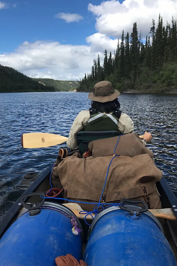
The next morning greeted us with crisp clean air and lots of sunshine and we took some time to have a hearty breakfast with bannock and honey, reorganise our gear before setting off on our first full day of paddling on the Teslin river.
Headwinds and a nightly visitor
The next few days brought us extremely unpleasant headwinds of force 4-5, with gusts of force 6, on a river that has only a low flow velocity in this area. We couldn’t make any real progress and were repeatedly blown sideways, which caused us a lot of frustration. After only 20 kilometres (in 6 hours!) on the first of the two days, we gave up, set up camp, wolfed down one of the travel meals we had brought along for evenings like this, took our food containers out of the camp and went to sleep. Our muscles had not yet got used to paddling and we felt exhausted and sore.
At 2 a.m., I woke up to cracking noises around our camp. Was it a bear? I didn’t really feel like going out to check, but staying in my sleeping bag was not an option, so I put on my headlamp, grabbed the lever action and left the tent. The crackling was still there, but now it no longer sounded like the breaking of large branches as I had perceived it in my half-sleep, but like that of a smaller animal making its way through the undergrowth. The bear turned out to be a porcupine, which crossed our camp without undue haste.
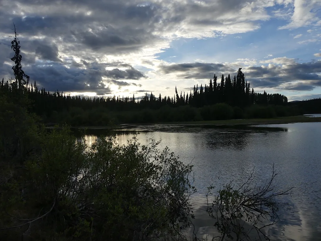
Relieved and smiling, I sat down on the bank and enjoyed the view:
Lesson #2
At the start of each of our trips, I repeat a few basic rules for the wilderness to my son and other participants like a mantra. One of the most important, especially in a remote area where help is, at best, a day or two away, is: move carefully and avoid unnecessary risks. One such unnecessary risk, for example, is going to the river in the morning, half asleep and wearing only neoprene socks on your feet, to wash.
A few days into the trip, I slipped in the mud on the bank of the Teslin and twisted my right ankle with an audible ‘crack’. My first thought was: anything but a torn ligament. Elias was still asleep and only came down to the river after I called him several times.
In the meantime, I had cooled my ankle in the cold river water. Elias brought me our medical bag and my heavy wading boots for fly fishing. With a tight bandage, neoprene socks, tightly laced wading boots and enough ibuprofen, I was able to walk slowly with the help of a stick.
If it turned out that it was indeed a torn ligament, I wanted to be as close as possible to 100 Mile Landing. There were a few cabins there that were partly inhabited in the summer, and the best chance of finding a motorboat that could get us back to Johnson’s Crossing within a day if necessary. Elias broke camp on his own, loaded the 80 kilos of gear and food into the canoe, and helped me get in. The ibuprofen took effect and we were in 100 Mile Landing within a few hours, where Elias set up camp. In the meantime, I took a look at my foot. I was relieved to find that it wasn’t a torn ligament, but probably just a bad sprain. The bruising was manageable and I could move my foot with tolerable pain. Nevertheless, we decided to take a day off.
100 Mile Landing
100 Mile Landing developed as a modest but persistent riverside settlement during the Teslin’s gold era. Like many such sites, it attracted not only prospectors but also individuals seeking to establish more permanent livelihoods once the initial rush subsided. In 1914, Joseph C. Brewer, a 55-year-old former worker from the Livingstone district, applied for a 160-acre homestead here. By 1918 he had cleared roughly ten acres, cultivated about one acre, and constructed a cabin, outbuildings, and fox and mink pens—shifting from mining toward small-scale agriculture and fur farming.
The archival photographs from 1922 show a substantial log structure and winter activity at the site, underscoring that this was more than a temporary camp. Yet isolation, harsh climate, and limited economic prospects took their toll. A note from 1924 indicates Brewer had left the territory due to poor health and was unlikely to return
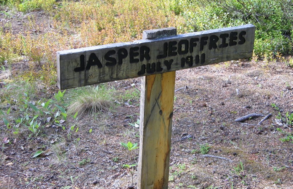
Today, the location is marked by collapsed buildings, decaying fox pens, and several grave outlines, including that of Jasper Jeoffries (d. 1911), whose burial reflects the stark realities of life—and death—along remote northern waterways.
What remains at 100 Mile Landing is not a ghost town in the dramatic sense, but a quiet archaeological footprint.
Picking up Speed...
Around km 150 the Teslin tightens up and you feel the difference straight away. The current jumps to about 7 km/h and does half the work for you. The weather finally turned for us here too. There’s a decent camp spot on river right just past where the Swift River comes in. Worth noting if you’re running out of steam.
At km 137 the Mary River joins and the Teslin starts throwing proper meanders at you. Pick your lines. We worked the outside of the bends and it seemed to pay off, faster water and fewer shallow spots.
Took another hour before we found anything usable. River right, around km 115, slightly raised and out of the wind. Nine hours, 60-odd kilometres. That was enough.
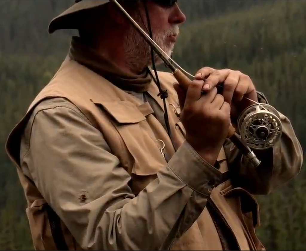
Fishing was great that evening and we caught 6 arctic graylings on elk hair caddis.
A Bull, a Bear and O’Brien’s Bar
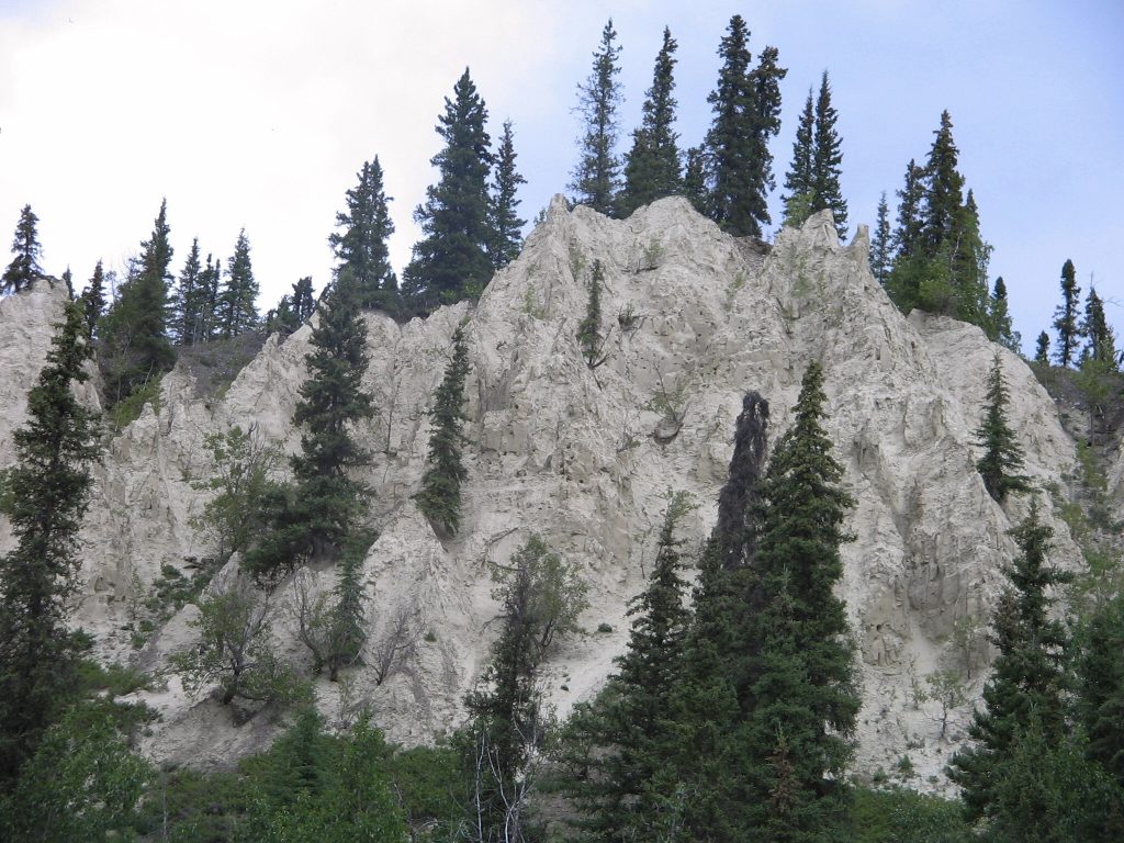
The Teslin has found its pace and so have we. The meanders swing wide through here, cutting into high banks where the sand has weathered into hoodoos. Strange pillars standing along the bluffs like something out of a desert, except everything around them is boreal forest.
Five clicks downstream you hit the Roaring Bull Rapids. Ignore the name. It’s a bouncy wave train, maybe thirty seconds of paying attention, and that’s it. Only whitewater on the whole Teslin. We whooped through it and wished it was longer.
Right after the rapids, river bending right, left bank, twenty metres out. A mid-sized black bear standing there staring at us like we’d wandered into his kitchen. We stared back. He held it for a few seconds, decided we weren’t interesting enough, and wandered into the willows. That was it.Past km 75 the river loses its curves and some of its push. Back to work. We grind out the last stretch and land at Brien’s Bar Camp around two, river left on a slough.
The place is named for Thomas O’Brien, a character who was already well established here before the Klondike rush even started. His main enterprise was moonshine. That funded everything else, including a gold mining operation that at its peak had 35 men working the Teslin gravel. By 1935 he’d had a full dredge shipped in. The man wasn’t messing around.
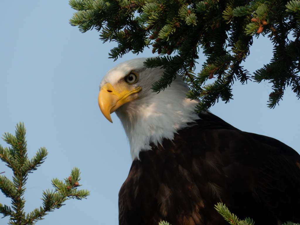
Between 100 Mile Landing and Roaring Bull Rapids, the Teslin flows broad and easy through a generous valley. The river sweeps in long bends past wide gravel bars that seem to invite frequent stops. The current is steady and dependable, carrying you along without much effort. Moose move quietly through the willow thickets along the side channels, and bald eagles circle high above the open gravel bars. A few miles before “Roarding Bull Rapids” we encountered our first bear. Despite the brownish coat, this is a black bear.
A bit on bears
Someone told us that, while bears (both black and brown) are abundant on the Teslin, encounters are actually rare. Nope, they are not and they were clearly talking out of their ass. We saw about half a dozen black bears and two grizzly bears. Only one of them got too close for (our) comfort and, of course, it had to be a grizzly. A young male made an approach while we were fly fishing for grayling at Miller Creek. We later realized that we had missed his scat when we landed on the gravel bank (see below!). He got within about 30 meters of us and Elias was getting ready to fire a warning shot, as we mostly avoided leaving camp alone and unarmed (or at least not withour bear spray), but after some huffing and puffing he decided that we were not worth it and ran off into the shallows. But he did stick around in the area and we didn’t sleep great that night.
A lot has been written about how to behave when paddling in bear country and what to do when things get hairy. Here’s our take in a blog article:
Paddling with Bears in the Yukon: What You Need to Know
Before You Worry … If you’re planning a trip to the Yukon, whether you’re paddling a river, hiking in Kluane, or just driving the Alaska Highway, someone will ask you about bears. Probably everyone will ask you about bears. Fair enough. The Yukon is proper bear country. Not the kind where a park ranger mentions there might be a bear somewhere in the area. The kind where you are sharing the landscape with thousands of them, and they were there first. Every river, every trail, every gravel bar you camp on is part of their home range. But the thing that gets lost in the worry: actual bear attacks are extremely rare. If you understand what you’re dealing with, take sensible precautions, and know what to do if things go sideways, you can travel safely through some of the best wilderness on the planet. Two Bears, One Territory The Yukon…
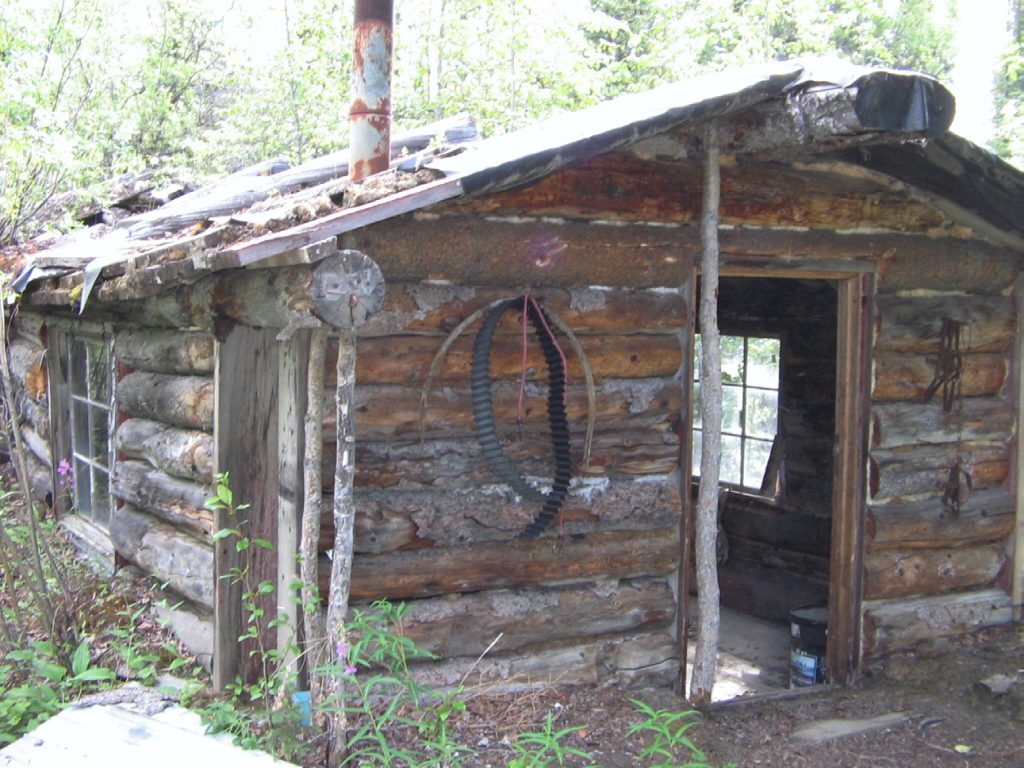
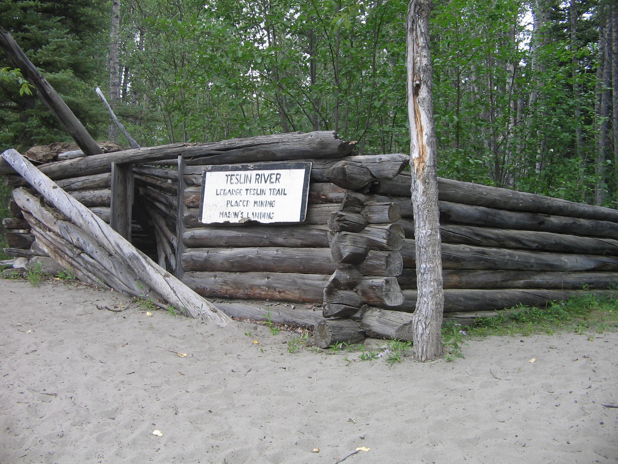
Mason's Landing
Mason's Landing sits on the Teslin River about 30 kilometres downstream from Hootalinqua. Most paddlers pass right by without knowing what happened here. A few old building remains, some scattered planks, maybe a fire ring. Easy to miss if you're not looking for it.
Gold was discovered on Livingstone Creek just before 1900. By the time the century turned, dozens of prospectors were heading in to stake claims. The problem was getting there. Whether you were poling a boat, paddling a canoe, or taking a small steamer from Hootalinqua, you had two options: Eureka Landing with its eighteen-mile trail, or Mason's Landing a few miles upstream with a sixteen-mile trail.
Those couple extra miles on the pack trail made sense when it saved several miles of upstream river travel. At high water, manually powered craft struggled against the current. At low water, steamers couldn't make it through. Mason's Landing became the better bet.
The Wagon Road
William L. Mason had been in the territory since 1898. His wife Hattie and daughter Hazle joined him soon after. He doesn't show up much in the historical records and apparently didn't stay more than a few years, but his name stuck to the place.
In 1902 the government decided to build a wagon road from Mason's Landing to "ten below Discovery" on Livingstone Creek. That's ten claims below the first registered claim. They spent over $10,000 that year, federal and local governments combined. The result was a proper wagon road that dropped freight rates from six to eight cents per pound down to two and a half cents.
The problem with the road: It crossed a summit that was heavily glaciated in winter. Spring melt washed away the improvements every year. Between 1904 and 1908, repairs cost the government around $1,500 annually. Despite the work, the route often degraded back to a pack trail, which meant freight rates went back up.
Winter Trails
During winter 1901-02, local miners cut a rough trail overland from Livingstone to Upper Lake Laberge. The next winter, three policemen and a group of miners spent almost a month improving the winter trail to Whitehorse. It connected to Lake Laberge about five miles north of the Upper Laberge police detachment.
The police delivered winter mail twice a week by horse, foot, or dog team via this trail or through Hootalinqua. The exact route where it crossed the Teslin isn't well documented, but they would have picked the straightest line possible: frozen muskeg, lakes, swamps. Anything flat and open. This was a route totally impassable in summer, one that would disappear in a few years without yearly maintenance.
The route likely followed what's now known as Teslin Crossing, or Winter Crossing. A local group headed by John R. MacDonald requested in 1903 that a trail be built from Mason's Landing to Whitehorse. The Mason's Landing road worked well as a steamer landing and wagon road in summer, but served little purpose in winter when the community was mostly deserted.
Life at the Landing
In its heyday, Mason's Landing had a roadhouse and stable, a telegraph station, and a small trading post. The telegraph line was constructed in summer 1907, running from Hootalinqua to Livingstone Creek via Mason's Landing. Cost about $4,700 to build. Heavy use of the line soon covered operating costs and showed returns on the original investment. You could still see the line following the right bank of the Teslin in the early 1980s.
Steamboats ran sporadically during summers. The British Yukon Navigation Company's Bailey, the Teslin Transportation Company's Anglian, Tom Smith's Quick (which served the whole Teslin River and even up the Nisutlin), and later his Frontiersman, plus Taylor & Drury's Yukon Rose all hauled goods on the Teslin. Various privately owned gas launches ran freight from Hootalinqua.
The NWMP reported in 1902 that the area needed scheduled boat service. "The B.Y.N. Co., however, do not seem to be willing to place a boat regularly on this run." So residents of the Livingstone area couldn't know when a steamer would arrive or when freight would show up. Made shipping perishable goods a gamble.
Police Work
The conditions the NWMP operated under were nothing like modern policing. Apart from law enforcement and mail delivery, they performed regular patrols to remote areas, worked as government agents, canoemen, and telegraph line repairmen (sometimes operators). Their salaries were generally less than what the average miner or labourer could expect to earn, and they often undertook dangerous duties with limited rewards.
In February 1903, Constable John Richardson was freighting supplies to Livingstone Creek. While harnessing a horse, he got kicked in the face and received a fractured skull. Spent a couple months in hospital in Whitehorse. Had to have one eye removed and lost all sight in the other. Residents, miners, and fellow policemen took up a collection and sent him home to his friends in Manitoba.
Decline
In 1912, John W. Brown applied for 160 acres of agricultural land at Mason's Landing. There were already buildings on the property, including the old roadhouse. Brown didn't stay long to establish his farm and the government cancelled the agreement in 1918.
Over the years, the Livingstone Creek mining district stabilized to support a relatively small population of dedicated miners. Too few to justify many of the previous support services. The summer road was still being used in the 1930s. Government geologist E.J. Lees claimed in 1938 that the Mason's Landing road was still in regular use in summer, but it gradually fell into disuse.
First Nation people utilized the site for packing and other services while also trapping and hunting. Government survey pack trains and hunting guides used the route. By 1938 an airstrip was constructed near Livingstone Creek, providing fast and relatively inexpensive service. As mining operations shifted to heavy equipment, that equipment was brought in over the winter crossing upstream along with large amounts of fuel.
When geologist Hugh Bostock returned in 1952 after a twenty-year absence, he found the site so overgrown it was "hardly recognizable."
Today
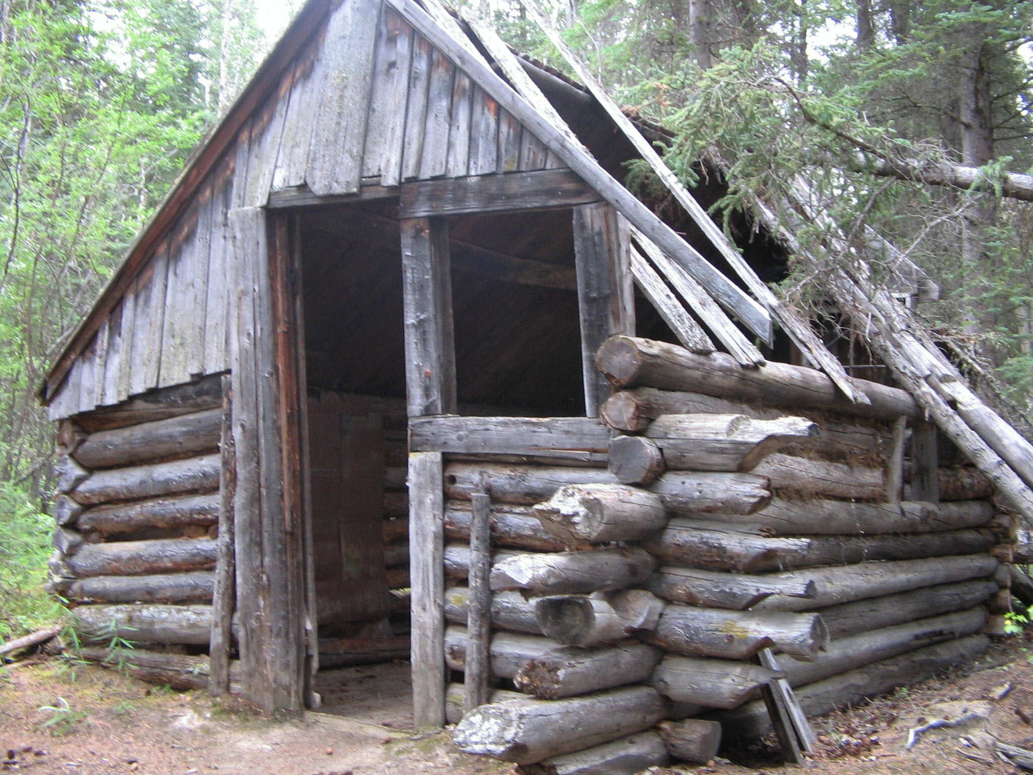
Several building remains stand at Mason's Landing. Ample room to camp. The Teslin River flows past like it always has. Most paddlers stop here for lunch or to stretch their legs, then push on toward Hootalinqua. The wagon road is gone. The telegraph line is gone. The roadhouse, the stable, the trading post, all gone. Just the bones of the place remain, slowly being reclaimed by the bush.
For paddlers: Mason's Landing is roughly 30 kilometres downstream from Hootalinqua, or about 170 kilometres into the Johnson's Crossing to Carmacks route. Good camp spot on river right with building remains visible from the water.
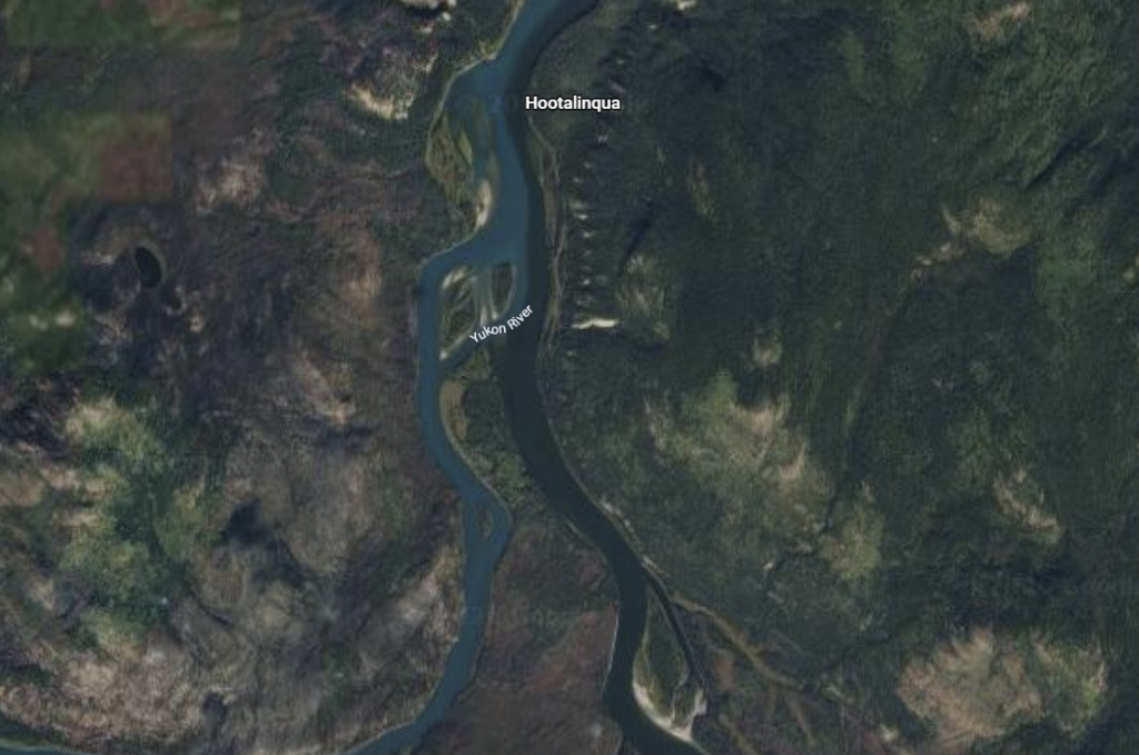
Hootalinqua
Hootalinqua hits you before you expect it. The Teslin swings around a bend and suddenly there’s another river right beside you. The Yukon, coming in from the left, bigger and muddier. For a stretch the two run side by side without mixing, a clean line down the middle where brown meets green. Then they merge and you’re on the Yukon proper. That’s a moment.
The Place
Hootalinqua sits where the Teslin meets the Yukon, about 210 kilometres upstream from Whitehorse. You can see the two rivers running side by side for a bit before they mix. Different colours, different speeds.
The name comes from the Northern Tutchone word Hudinlin, meaning “running against the mountain.” Before any of the gold rush activity this was a meeting and trading spot for Northern and Southern Tutchone and Inland Tlingit. Rivers were the highways and this was the junction.
The Gold Rush Era
By 1896 about a hundred miners were working claims in the area and Hootalinqua became a supply point. The NWMP put up a post here in winter 1897-98, manned by two constables. That winter three steamers wintered at the site. In 1899 the Bennett Lake and Klondike Navigation Company closed their roadhouse here but the Dominion Telegraph Service opened an office. They ran a spur line out to Livingstone Creek in 1907. The NWMP had planned to close the detachment for winter but new discoveries brought people in so they kept it open.
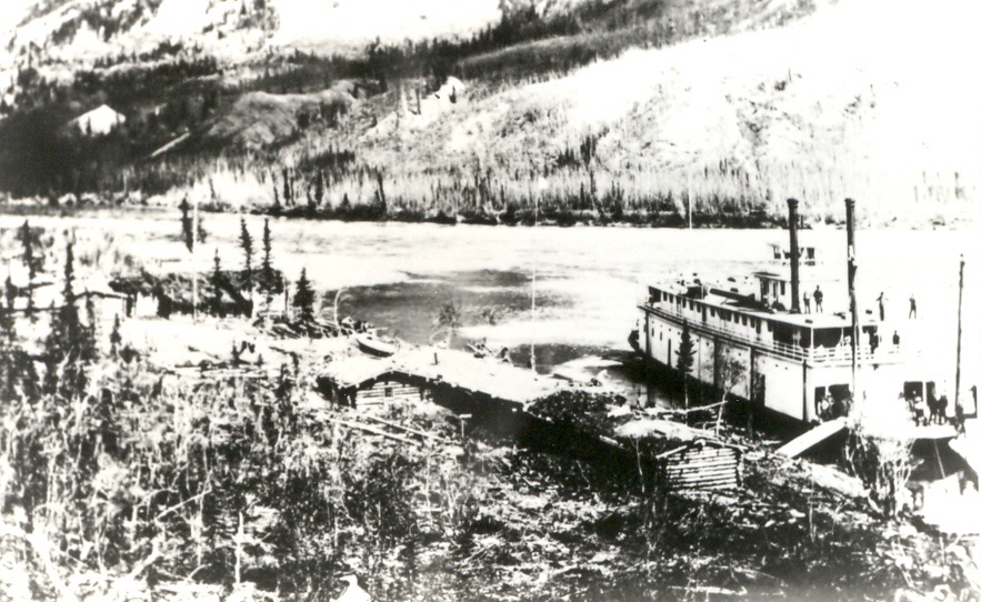
Steamboat Infrastructure:
Around 1903 the Dominion Steamboat Company built the Sifton Ways here. Not complicated: just secured timbers running perpendicular to the river so you could skid boats in and out of the water. Before that steamers were left in backwaters or tied off with cables.
The British Yukon Navigation Company took over the ways from 1904 to 1909. In 1913 they built more extensive ways on Shipyard Island downstream to handle larger boats. Several vessels could be pulled up for repairs or winter storage at once.
Life at the Junction
Dan Snure ran a store and roadhouse here in the early 1900s. Kept a lot of dogs for hunting and hauling. In 1904 he petitioned the government for payment after he'd built a trail from Hootalinqua to Lower Laberge. Mail service was patchy. People kept asking for it between 1900 and 1914 but nothing consistent happened until 1914 when George Scott got a contract to deliver mail to Big Salmon and Hootalinqua.
By 1913 there was a brief uptick. New ways getting built, a winter caretaker living there with his family: Captain Hoggan and crew had been there three years running. But no real population ever materialized. In 1914 it was just the telegraph operator and his wife. That would be Jack Ward who married Lill Hoggan. They had a twenty-foot greenhouse and stayed until 1925. About a dozen log houses stood here then, most of them already falling apart.
People ★☆☆☆
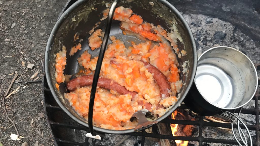
When we approached Hootalinqua, we hadn’t seen or heard another human for more than a week. And so it was quite a surprise to us that we were greeted with a very loud fight a couple was having in Swiss German. We briefly considered moving on but the camp site looked too inviting. So we decided to pull into the next inlet and make camp. We hadn’t fished that day and so we had to fall back to dried sausages with potatoes and carrots. The couple “next door” had stopped fighting and instead started playing music on a bluetooth speaker. An hour later, they were back at debating. Let’s say we weren’t in the best mood when we crawled into our sleeping bags.
Porcupine Burgers ★★★★
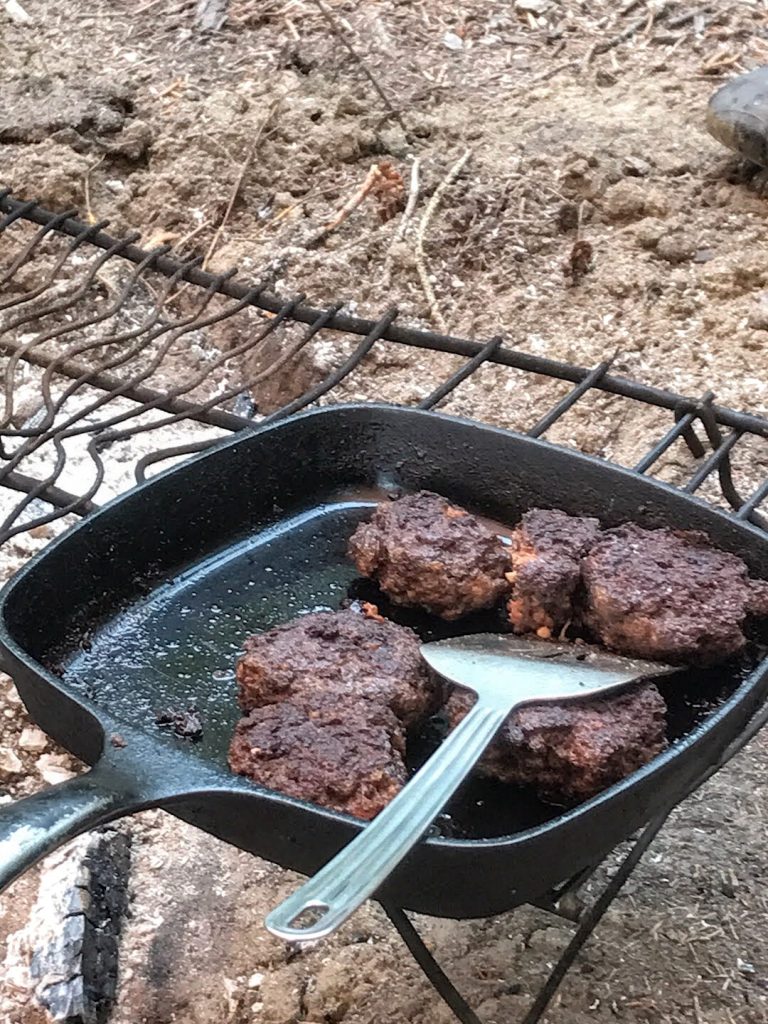
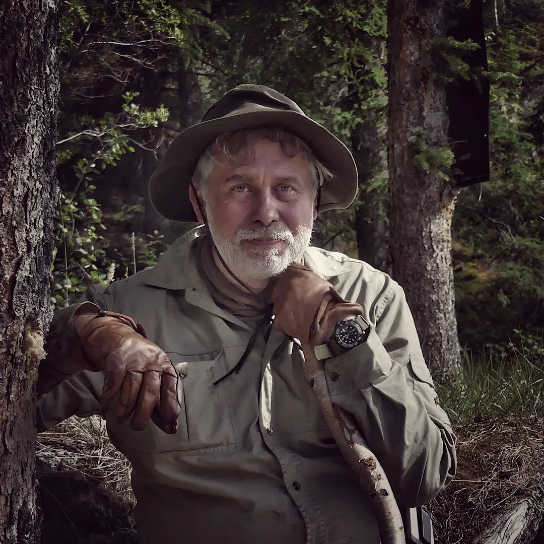
“Hi, lads. I just clubbed a porcupine and made meatballs out of it. Would you like some?” With these words, D. invited us to his camp. He stood on top of the promontory that separated “our” two inlets: wild-haired, grinning, sunburned, and stringy in his boxer shorts. He had been a tanker captain in his first life, but since the mid-90s he has been a “globetrotter.” He spends five months every year on the rivers of the Yukon and the other half (more or less) in Oz, and we were to learn a great deal from him over the next few days.
Some would say that D. had maybe been alone a little too much and was a bit “eccentric,” but he showed us that he was a kind-hearted, funny, and caring person, an excellent bushcrafter and wilderness cook. And hey, most people Elias and I meet find us at least a bit eccentric, so who are we to judge anyone?
And yes, he had indeed killed a porcupine with a club, enjoyed the liver with apples and onions (but without Chianti) the night before, which he said was delicious, and put the rest of the usable meat from the porcupine through a meat grinder. He always carries one with him and, according to him, it makes almost any meat edible that would normally require hours of cooking, as porcupines are very tough little beasts.
We decided to stay in Hootalinqua for another night (partially trying to avoid the Swiss couple) and had a wonderful evening by the campfire with stories, song, beer and great company